River Nile
The Map of River Nile
The Nile flows through 10
countries: Sudan, South Sudan, Burundi, Rwanda, Democratic Republic of the
Congo, Tanzania, Kenya, Ethiopia, Uganda and Egypt. It’s the worlds longest
river.
Length: 6650 km (4130 miles)

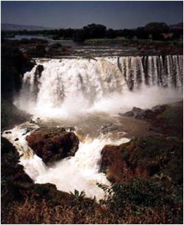
Source to Mouth
The River begins a six month journey from Ethiopia, through
Sudan and Egypt, and finally flows into the Mediterranean Sea.Melting snow and heavy summer rain in the Ethiopian
mountains, sends a torrent of water
causing the banks of the River Nile in Egypt, to overflow on the flat desert
land.When the floods go away,
it leaves a thick, rich, black mud called silt. This is excellent soil
to plant seeds in after it has been ploughed.


Occupations on the Nile
Many such occupations thrive on the Nile for the dependency of their survival for example: fishing.

Farmers made channels from the river to water the crops


 The
Black Land and The Red Land
The
Black Land and The Red Land
Food and Trade with Transport
The Nile also gave the ancient Egyptians food.
They used spears
and nets to catch fish. They would also use nets to catch birds that flew close
to the surface of the water. Some got
breakfast, lunch and dinner from the river. The Nile was the quickest and easiest way to travel from
place to place. They made river boats to move large, bulky things.


Pollution
- Chemical pollution: The need to use artificial fertilizers supplied by international corporations is controversial too, causing chemical pollution which the traditional river silt did not.
- Salinization: Indifferent irrigation control has also caused some farmland to be damaged by waterlogging and increased salinity, a problem complicated by the reduced flow of the river, which allows salt water further into the delta.
- Spread of disease: The dam has been implicated in a rise in cases of Schistosomiasis (bilharzia), due to the thick plant life that has grown up in Lake Nasser, which hosts the snails who carry the disease.
- Affecting marine ecosystem: Mediterranean fish stocks are also impacted by the dam. The eastern basin of the Mediterranean is low in fertility, and traditionally the marine ecosystem depended on the rich flow of phosphate and silicates from the Nile outflow.
Papyrus
•Reeds called papyrus,
grew along the banks of the Nile. The Egyptians made paper and boats from the
reeds.
